GIS mapping tools that start with the planning question
Plynth is a planning-aware GIS workspace for selecting a NSW parcel or drawing the geography that matters, then inspecting planning, hazard, infrastructure and place layers against a defined question.
The mapped observation stays connected to the selected area and written source. Plynth does not replace survey evidence, official project checks or a general-purpose desktop GIS.
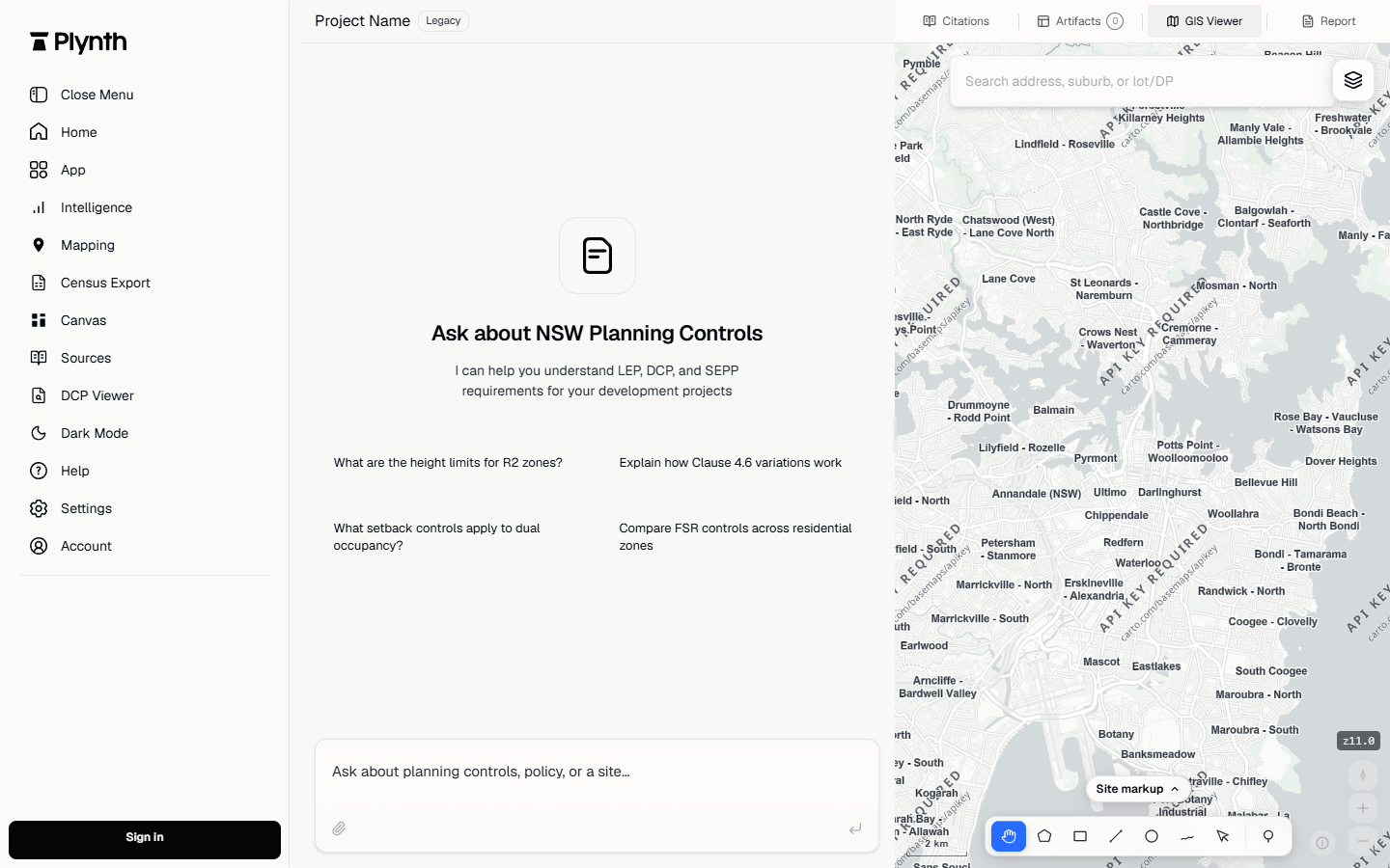
Resolve the land before switching on layers.
Begin with an address, lot or selected area and verify the returned geography. The address pin is a search aid; the parcel or deliberately drawn boundary is the analytical unit.
If the boundary is unclear, stop and record the uncertainty rather than selecting the nearest coloured polygon.
Choose layers that answer a defined site question.
Zoning, height, heritage, hazard, infrastructure and development layers answer different questions. Plynth keeps the selected layer set visible so a map can be read as a record rather than a decorative screenshot.
A layer may be current, historical, non-EPI or maintained on a different update cycle. Its name and publisher matter as much as its colour.
Connect each map observation to its written source.
A map can identify a displayed value or intersection. The governing provision explains what that observation means and whether a trigger, definition or exception changes the result.
The NSW Planning Portal itself warns that spatial updates can lag an instrument change. Plynth therefore keeps the observation date and written source distinct.
Draw the study area and carry it into the analysis.
Use a parcel when the question is parcel-specific, or draw a wider area when the question concerns a corridor, centre or surrounding activity. The chosen geography carries into the comparison and report.
That continuity reduces the risk of answering a question with statistics or observations from a different boundary.
The map records the observation, source and precision limit.
The current GIS capture proves the working relationship between map tools and conversation. A project record should retain the fields below for every material observation.
| Subject | Finding | Source | Boundary |
|---|---|---|---|
| Selected geography | Parcel or drawn boundary retained as the analysis input. | Official parcel context or user-drawn study area | An address pin is not treated as the legal boundary. |
| Planning layer | Displayed value or intersection recorded with layer name. | Named NSW Planning Portal dataset or incorporated map | Check update date, mapping status and edge conditions. |
| Written rule | Relevant provision linked beside the map observation. | Current official instrument | The map alone does not establish the legal consequence. |
| Report handoff | Map figure and selected geography carried into the output. | Plynth GIS workspace and area-report workflow | Verify scale and precision before project reliance. |
What this workflow does not establish.
- Plynth does not claim survey-grade accuracy or replace official project mapping checks.
- Layer coverage and currency are dataset-specific; one site-wide timestamp cannot prove every layer is current.
- Current product coverage is NSW and does not imply a complete Australian planning-map corpus.
Check the source and its date position.
These sources support the public explanation and worked specimen. The official publisher remains the authority.