Town planning software that keeps the site and source together
Plynth is town planning software for moving from a NSW site question to a checkable planning record. It resolves the land first, keeps mapped controls and source provisions beside the answer, and carries the working evidence into an editable report.
The software supports the planner's investigation; it does not make the professional conclusion or predict whether consent will be granted.
Start with the parcel before reading isolated controls.
Planning controls attach to land. Plynth begins with an address, lot or selected area and establishes the spatial context before it searches for the rules that may apply.
That order keeps zoning, height, floor-space ratio, heritage, hazards and infrastructure attached to the same site record instead of becoming a collection of disconnected look-ups.
Inspect the source behind the planning answer.
Ask a planning question in plain English and open the provision, judgment or code reference supporting a material claim. Source identity and the cited words remain visible so the answer can be checked.
A citation proves what the named source says. It does not, by itself, decide whether the provision applies to every proposal or resolve a discretionary planning assessment.
Separate measured controls from matters requiring assessment.
Where the required inputs are available, measurable controls can return a pass, fail or undetermined state. Merit questions remain identified as matters requiring professional assessment.
This boundary makes it easier to see which part of the record is an observation, which part is a calculation and which part still needs a planner's judgment.
Carry the map and citations into the next document.
Selected-area reports are editable and retain the map figure, controls and citations used in the investigation. They provide a working evidence base for diligence and project documentation.
Automated scaffolding for Statements of Environmental Effects, clause 4.6 requests and Heritage Impact Statements remains on the product roadmap.
One planning question, four retained evidence states.
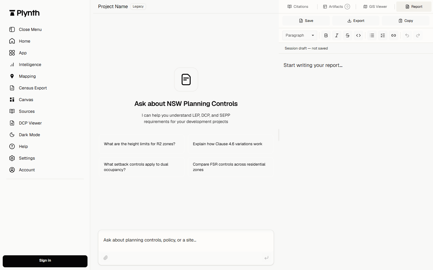
The current product capture shows the conversation and report surfaces before work begins. The table states the evidence contract for the workflow without claiming that the empty capture proves a completed project outcome.
| Subject | Finding | Source | Boundary |
|---|---|---|---|
| Land | Parcel and selected geography are resolved before policy reasoning. | NSW Planning Portal spatial context | Verify parcel identity and map currency for the project. |
| Rule | Material answers retain a link to the supporting provision. | Current NSW legislation or named official publisher | A source extract does not decide project-specific applicability. |
| Control | Measurable checks remain distinct from merit assessment. | Recorded project inputs and cited control | Missing inputs return undetermined rather than a guessed result. |
| Output | The working report remains editable and cited. | Plynth product capture | The responsible practitioner reviews the report before relying on it. |
What this workflow does not establish.
- Plynth does not guarantee consent or replace project-specific professional judgment.
- A map observation must be read with the governing written provision and any project evidence.
- The full feature set is launching in NSW before rolling out to other states and territories. Availability varies by feature and location.
Check the source and its date position.
These sources support the public explanation and worked specimen. The official publisher remains the authority.